In the early summer of 2024, I had the opportunity to make a fantastic single-handed trip from the southern Baltic Sea coast to southern Norway and back again.
My original plan was to sail as quickly and as far north as possible, then take my time to explore southern Norway and return to Germany in smaller stages.
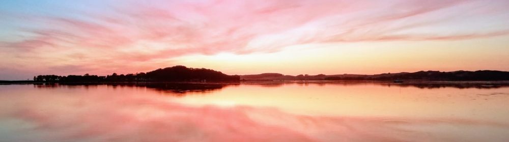
I managed the first 120 nautical miles from Kröslin to Helsingoer well and quickly in a strong easterly wind (6 – 7 Beaufort at times during the day). Unfortunately, there is a lull at first and in the following days the wind comes back only shakily and from a W-NW direction, so that I have to cross the Kattegat at times and don’t really make much progress. On the other hand, I don’t want to spend hours doing monotonous passages under engine power, so I sailed in rather short stages whenever there was a favourable wind.
You can find a video of the first few days of the trip here:
In the end, I arrived in Christiansand in southern Norway after 6 days and first had to weather a day of strong winds. Originally, I had dreamed of getting at least to Stavanger and the Lysefjord. However, the remaining time budget didn’t allow for any more big leaps northwards, especially as the weather forecast predicted strong northerly winds for the south-west coast of Norway over the next few days. Trying to master an unknown and challenging coastline by force is not really my thing.
I then decided to make the best of it and take my time to enjoy the beauty and special features of the area and also to tackle the later return journey in relaxed stages.
Christiansand is a nice, tidy town situated at the mouth of a river in a small fjord. The marinas, including the guest marina, are located between a small fortress to the east and a rock formation about 50 metres high to the west. The guest marina consists of floating concrete pontoons and the harbour is rather choppy, especially in swell from the south.
I use the strong wind day to wander around a bit and stock up on provisions. The next day there is still a strong, only slowly easing south-easterly wind in the harbour, so I don’t dare to leave the marina until around midday and start by bunkering diesel. Not an easy manoeuvre as I want to moor to leeward of the petrol station pontoon and have very little room to leeward as it gets shallow there very quickly. The manoeuvre succeeds and in the early afternoon I set off to go just a few miles further west.
My destination is Ny Hellesund, a narrow and picturesque sound between the islands of Monsœya and Helgœya, halfway to Mandal, which is recommended as worth a visit in Judy Lomax’s very beautiful and instructive RCC cruising guide Norway. I can sail the approx. 15 miles to there under the protection of the offshore islands and therefore don’t have to worry about the rough and unpleasant seas off the coast. The sky is grey and rain showers keep pelting down. I only sail between the islands with a double reefed main and make good progress. Before entering the very narrow sound, I take the main down and motor into the sound.
Despite the bad weather, the scenery is picturesque. To the left and right, the rocky shores drop steeply into the water and some of the cliffs and gorges are wooded. Picturesque little houses with jetties, moorings, small boat garages and bathing ladders can be found in small bays and alcoves. However, there are very few boats and no people to be seen. The season has obviously not yet started here at the end of May. The wind is whistling through the sound in strong gusts and there is a light current. I recognise some iron rings for mooring to the steep rocks, but mooring single-handed is too risky for me in these conditions and I also want to explore the island a little, which would not be possible over the rocks.
I finally moor up at the ferry pier and see on the timetable that the evening passenger ferry is due to arrive in 10 minutes. And indeed, a little later a motorboat comes roaring round the corner and bobs for a few minutes in front of the jetty, but without mooring, as there are no passengers to be seen for miles around. I decide to spend the night here and prepare my dinner after mooring up.
After lunch, the weather clears up a little and I set off on a short walk around the island. There are no paved paths and the shoreline is dotted with colourful, pretty little houses in beautiful old gardens and small bays. I follow a path towards the highest point of the island, which I want to climb. The houses and gardens soon come to an end and are replaced by tiny pastures and fields. Eventually, the path leads through a wilderness of rocks, trees and bushes. I come to a narrow gorge that leads steeply upwards and at the end I reach the highest point of the island via several rocks. I am briefly startled: there is actually a person standing up here looking into the distance. The only one I meet on this island. From here you have a fantastic view down into the sound and to the neighbouring islands.
The next day the wind has calmed down further and we set off early in the morning towards Mandal. Once again I can stay in the sheltered waters between the islands and sail most of the 18 miles to Mandal.
Mandal is the southernmost town in Norway and is surrounded by forests at the mouth of the Marna, a small river that flows from the mountains. The river is navigable for about half a nautical mile up to a footbridge in the town centre. There are small shipyards and marinas on both sides. The old harbour has been largely gutted and built over with smart modern residential buildings. On the northern bank is the guest harbour, which is still very sparsely occupied at this time of year. The river flows with perhaps a knot and, as is often the case in Scandinavia, carries a lot of wood and shavings with it.
An older compatriot lend me a hand for mooring and we discuss our routes and plans. Later, I meet other sailor couples who have waited out the strong winds of the past few days and are now heading further north. From here northwards, there are more and more sections where there is no shelter for long stretches and where you should wait for a suitable weather window to pass. Personally, I like sailing alone, but I am sometimes a little envious when I see couples who, even aged, still bravely master the routes to the north together.
For my part, I’ve finally come to terms with the fact that I won’t be going any further north and am preparing to explore and enjoy the south coast of Norway and then the west coast of Sweden in smaller stages on the gradual way back south. Until the wind turns to the west and I can set off on my return journey, I enjoy the small town and its surroundings. The town is well laid out and beautifully situated by the river. There is a large and busy road right by the river, but in the 2nd row there is a pedestrianised area with shops and cafés in beautiful old houses. From the local hill you have a very nice view over the river and harbour.
The wind is due to shift to the south-west next Sunday and I decide to spend another night at anchor before setting off on my return journey. I move the boat into a sheltered and quiet bay a few miles from Mandal between the islands at midday on Saturday. The entrance is a little tricky, but doable, and in the early afternoon the anchor drops to a depth of 4 metres in bright sunshine. A few pretty holiday homes are nestled between the rocky hills, but only a few of them seem to be occupied at the moment, despite it being the weekend.
It’s so warm and summery that I can’t resist getting into the water and swimming and then scrubbing the waterline around the boat. Marvellous!
Around midday on Sunday, the hoped-for westerly wind comes up very lightly at first. I take down the awning, lift the anchor and set off. When I’m between the islands at about the height of Mandal, I’m called on the radio by the Norwegian coastguard and asked if I’ve seen a small sailing boat that they’re probably looking for. I have to say no, I haven’t actually seen a single ship today. I don’t know why they called me, maybe they saw my AIS signal in the exact area where the missing boat is believed to be.
I reach the open sea between the islands and the wind picks up steadily. Space sheets at 3-4 Beaufort and bright sunshine: this makes it easier to start the return journey. I spend the whole afternoon and evening sailing a relaxed 35 miles parallel to the coast.
My destination is Gamle Hellesund, where I want to spend the night and continue to Arendal or Risoer the next day. At around 20:00, I thread my way between the islands and some large fish farms and make my way through a very narrow channel into Gamle Hellesund, where I tie up to a mooring and spend the night well protected.
I take it easy the next morning and set off at around 10.00 a.m. with a nice westerly wind. The first 20 miles are along the coast outside the islands. Unfortunately, I can’t take the famous Blindleia, the scenic inner archipelago course, because just before Lillelsand a road bridge with a clearance height of 19 metres crosses the fairway: that’s a few centimetres too short for my mast. Late in the afternoon, I reach the fairway behind a group of islands in the direction of Arendal. It’s marvellous to sail in here with a fresh westerly wind, the sound and the town offer a fantastic view.
I continue eastwards under the protection of Tromoya Island. I moor in Risoer at around 8.00 p.m. – after just under 50 miles of sailing astern wind through mostly sheltered waters. After dinner, I wander around the beautiful town a bit and regret that I don’t have time to stay here a little longer. But the forecast for the next few days is for a drop in temperature and repeated gales of 7 – 8 Beaufort from the west, so I want to get to the relatively sheltered waters of the western Swedish archipelago as quickly as possible.
That’s why I set off early on Tuesday morning: the wind is expected to reach 30 knots by midday and I want to be in Stavern by then to weather the following storm. When I reach Stavern at midday with only a double reefed main, the wind is already blowing from the west at up to 30 knots. The wind is so strong that the autopilot can barely keep the course against the wind when I lower the mainsail and I wonder how I’m supposed to dock without an accident in this storm. Just behind the entrance, I discover a relatively sheltered spot to windward at the very beginning of the guest bridge and wonder whether it is deep enough there. Fortunately, a sailor appears and waves me over, assuring me that it is deep enough. I can slowly go alongside the bridge against the wind and, as I am immediately assured, I have got the best and most comfortable guest berth in the whole marina.
I like the small town. There’s a fortress island off the coast, a disused former naval dockyard from the 19th century, parts of which can be visited, and a rather mighty memorial to the Norwegian sailors who remained at sea. And a surprising number of cafés and restaurants. In the evening, I strike up a conversation with the manageress in a restaurant, who tells me with some excitement that she was also the harbour master until last summer. Now there is no longer a harbour master, as in most harbours in this area, and everything is automated and the yachties are on their own. Times are changing, here as everywhere.


After a stormy day’s break, I continue across the Skagerak to the Swedish island of Koster on Thursday morning. A dream destination that I’ve always wanted to sail to. I’m making good progress with 5 – 6 Beaufort, although I’m mainly sailing with the main reefed twice and only occasionally with the jib partly furled. If the wind picks up massively from time to time as forecast, I don’t want to have to force the entire jib in. The Furlex would be able to do this with winch support, but the sail is twisted badly every time under the wind pressure and this is too much of a strain on the material in the long run. About 5 miles west of Koster, the bottom rises from 100 metres and more with a very irregular seabed relief to 10 – 12 metres in places. I expect to encounter a very choppy and rough sea here. At the same time, a heavy squall appeared in the south-west, which actually hit me during the approach to Koster with showers and gusts of up to 40 knots in the flattening water. Pretty exciting, Kattegat at its best.
I reach the leeward shelter of Nord-Koster safely and sail slowly to Kostersundet, where I moor in a nice, sheltered spot for the night. All afternoon and evening, the wind whistles through the sound, which proves to be a jet. The island is beautifully unspoilt with no road traffic, bays and beaches, cliffs and wooded heathland with few buildings adapted to the natural environment. Here, too, it is not yet the season at the beginning of June, the few fish stalls and restaurants are still closed and most of the holiday homes are not yet occupied.

The next morning, the wind blows 4 Beaufort from WSW in bright sunshine and I set off at around 09:00 with the aim of using the sheltered archipelago fairway to the south. Only between South Koster and the entrance to the fairway and another short section just before Grebestad do I have to reckon with wind and sea from the open Skagerak. Otherwise, the winding fairway is well protected and leads through a marvellous island landscape. However, this comes at the price that the wind is sometimes weak and changeable in the shelter of the islands, so that the engine often has to help out.
Idyllic bays and harbours alternate with breathtaking rock and forest formations that I can’t get enough of. Only the sometimes huge remains of 19th century quarries are a nuisance from time to time and indicate a lively pre-industrial hustle and bustle in this otherwise largely naturally left area. Basalt and granite were quarried here on an industrial scale – under ideal conditions for extraction and transport by ship – for the global boom in urban development at the time.
My destination for today is the Hamburgösund, which turns out to be rather disappointing. It is very narrow and picturesque, but every little spot near the shore is built up or otherwise utilised. Moorings everywhere, private or commercial, and already overcrowded at this early time of year. I could still have a spot right next to the shuttle ferry, but it’s too cramped and too busy for me. I continue for another half hour and moor up in a small, well-protected bay between the islets of Dannemark and Ulön. Despite the now stormy westerly wind, I spend a quiet night here.
The wind is supposed to drop a little the following afternoon and as there is now a short but rather unprotected passage through the archipelago to the west, I wait until midday the next day before continuing my journey and passing the critical passage quickly under engine power and with a double reefed main. It rains a lot and I soon reach the Sote Canal. This really is the narrowest canal between the western Swedish archipelago that I have ever travelled through. Partly of natural origin, partly blasted into the rocks by labourers in the 19th century, for whom there was no more work when the economy for basalt and granite mining declined.
At the end of the passage, I reach Smögen, which I already know from several visits, so I continue in sheltered waters to the island of Malmön, where I want to weather the coming storm. I first try the old fishing harbour on the island of Kalven. But just as I’m approaching, a heavy squall comes up and I don’t want to manoeuvre in the very narrow harbour basin under these circumstances. So I turn away and moor in the large marina, where there is plenty of room at this time of year.
I spend the following stormy day hiking across the island, which is very beautiful on the east side, but very rough and exposed on the west side, and in some places downright devastated by rock mining.


The next morning I continue southwards in westerly winds of 4 – 5 Beaufort, passing the beautiful double island of Kornö and the enchanting little town of Gullholmen on the island of Hermanö. I’m keeping both as absolute dream destinations in case I’m lucky enough to visit this wonderful area again. After Hermanö, I set off with a double reef in the main and jib across open water with quite rough seas to Marstrand, which welcomes me with sunshine and dignified luxury. I take a walk around the early summer island and enjoy my last day in the Swedish archipelago.
Very early the next morning I set off for Skagen with a light south-easterly wind, a “stone’s throw” of just over 30 miles and really fine weather sailing. Around midday, I cross the shipping lane off Skagen, which is full of large freighters and, contrary to the weather forecast, the wind holds, so I leave Skagen to starboard and sail a little further south-west to Strandby in Albaek Bay, a little north of Frederikshavn. A small Danish fishing harbour and marina between long beaches. I treat myself to one last fish and chips in a simple but good restaurant right by the harbour.
This time I don’t want to do the 220 miles back to Germany in one continuous trip, but in two stages. Simply because crossing the Sound at night is exhausting due to the ship traffic and there is also a favourable westerly wind forecast for the next few days, so I’m under no time pressure. So the next morning I sail about 120 miles to Helsingoer, where I moor for a few hours at around 01:00 in the morning.
The harbour is bursting with yachts from all over northern Europe that want to take part in the Sjælland Rundt. I lay across the pits and set off again at 07:00 a.m. for the last 100 miles to Rügen. I reach Falsterbo just before 14:00 and barely make it through the bridge opening. A fantastic south-westerly wind drives me across the Baltic Sea to Rügen and I moor in Glowe at around 23:00.
From here it’s a short hop to Sassnitz the next day and another day later to Kröslin, where I really get my nose in front of Prorer Wiek at the end of the trip: a squall comes from the west at up to 40 knots, but quickly moves on and leaves behind a reasonable sailing wind that brings me home.
In total, I travelled almost 1,000 miles in just over 3 weeks and mainly experienced the southern Norwegian and western Swedish archipelagos. I was surprised and delighted at how much distance you can actually cover in these waters, which are relatively sheltered by the archipelago. However, the restriction “relatively” should actually be taken literally: there are always sections between the skerries where a wild and sometimes chaotic sea comes in from outside in strong winds or storms and sometimes there are very strong jet effects between the rocky islands.
Precise and careful planning of the passages between the skerries is absolutely essential, not only to avoid the aforementioned risks in strong winds or storms, but also in moderate conditions: sometimes the routes are so winding and tricky that you can get confused in the hectic rush of an acute situation. Last but not least, you have to check carefully whether all the bridges you have to cross are high enough for a problem-free passage. I had actually plotted a route for all the passages in the electronic chart the day before so that I could simply follow this route en route and no longer had to make any critical decisions. However, it’s a complete mystery to me how people who didn’t live in the archipelago were able to find their way around without electronic aids in the old days. Hats off to those who ventured into these waters with only a paper chart and the means of terrestrial navigation.
I was pleasantly surprised by the friendliness and openness of the Norwegians. In Norway I was actively approached by locals almost every day: sometimes simply with friendly curiosity about my trip, sometimes with proactive information about local specialities. The Norwegians seem to me open and at the same time relaxed and laid back.
Finally, the overview map. I have now seen a lot in Skagerak and Kattegat and know that I really want to return to this wonderful area.
